Sunday, July 26, 2015

2015 Dragon 3 Symposium and best poster award

Hello,

before summer holidays I had the pleasure to participate 2015 Dragon 3 Symposium held in beautiful city of Interlaken, Switzerland. Dragon program is about co-operation between ESA member states and China. The symposium had good atmosphere, and I personally was delighted to receive "best poster award" for my poster presentation. Thanks! Feels good.

As I mentioned the city of Interlaken  between two lakes  is beautiful and surrounded by great mountains. The mayor of Interlaken gave a nice opening to the symposium and told that these days Asians are the most important tourist group in the region, and they come to Switzerland to visit mountains and to buy watches. This fact can clearly be seen in Interlaken, although, I believe that this time around there were even more Chinese people than usual!

On the way back to Zürich Airport I had a chance to visit Bern, and the Einsteinhaus in particular. In that little apartment he wrote the "Annus Mirabilis papers". The one on the photoelectric effect got him Nobel Prize in 1921.

Below are some photos.

Ciao,
Janne

The symposium plenaries were held in a very fancy room. Probably an old theatre.
The workshops were held in normal rooms. Here Erkki is presenting something fancy with Einstein in the middle.
Nice view! 
These skydivers were everywhere!
The Einsteinhaus – right.
The Einsteinhaus  left.
The Einsteinhaus – center. The studio apartment was actually really small.
The Einsteinhaus – window.
Oh, and the "best poster award"!

Wednesday, July 22, 2015

Smoke to Europe from East and West

Hi guys,

SAMPO observed this nice little thing


Those clouds are smoke from Alaska and Canada, and came here from East and West. See also the "Smoke Goes Around the World" by NASA's Earth Observatory website.

Oh, and Happy Summer!

Janne

Monday, June 22, 2015

Sulfur dioxide from Iceland to Finnish Lapland (Bárðarbunga-Holuhraun, September 2014)

Hello,

here are the FMI "science news" of our SO2 paper. First in Finnish:
Satelliitti-havainnot varmistavat: Bárðarbunga-Holuhraun tulivuoren päästöt kulkeutuivat Islannista Suomeen viime syksynä
Satelliitti-instrumentit ja maapinnan mittalaitteet havaitsivat korkeita ilmakehän rikkidioksidipitoisuuksia Lapissa.
Islannin ilmatieteen laitos raportoi 16. elokuuta 2014 kasvavasta vulkaanisesta toiminnasta Bárðarbunga-tulivuoren lähistöllä. 31. elokuuta purkaus alkoi Bárðarbungan koillispuolella sijaitsevasta Holuhraun-halkeamasta. Tästä ns. rakopurkauksesta syöksyi ilmakehään runsaasti rikkidioksidia, mutta ei juuri lainkaan tuhkaa.
Rikkidioksidi (SO2) on pitkäikäinen kaasu, joka voi kulkeutua kauas päästölähteestä, kuten tulivuoresta. Rikkidioksidi on suurina pitoisuuksina myrkyllistä maanpinnan lähellä ja vaikuttaa ilmanlaatuun ja ihmisten terveyteen.
Koska rikkidioksidin määrä on normaalitilanteissa ilmakehässä vähäinen, sitä voidaan käyttää tulivuoren päästöjen seurantaan.
Kohonneita SO2-pitoisuuksia havaittiin satelliitti-instrumenteilla Islannissa 1. syyskuuta 2014 (punaiset alueet kuvassa). Seuraavina päivinä tulivuoresta peräisin olevaa rikkidioksidia kulkeutui itään ja saapui Suomeen 5. Syyskuuta. Tämän jälkeen, korkeita SO2-pitoisuuksia havaittiin Pohjois-Suomessa useita kertoja syyskuun aikana. Lapissa tulivuoriperäiset rikkiyhdisteet aiheuttivat pahaa hajua ja myös näkyvyys oli paikoin heikentynyt. Terveydelle tästä ei aiheutunut haittaa.
Julkaistussa tutkimuksessa käytettiin NASAn EOS-Aura satelliitin OMI- (Ozone Measurement Instrument) sekä Suomi-NPP-satelliitin OMPS (Ozone Mapping and Profiler Suite) -instrumenttien tekemiä rikkidioksidihavaintoja. Operatiiviset OMI ja OMPS SO2-tuotteet kattavat koko maapallon ja ovat saatavilla muutamia tunteja satelliitin ylilennon jälkeen. OMI:n ja OMPS:in rikkidioksidihavaintoja vastaanotetaan myös Sodankylän kansainvälisellä satelliittipalveluasemalla. Näitä Pohjois-Euroopan alueelta saatuja rikkidioksidihavaintoja jaetaan Sampo-palvelun kautta (http://sampo.fmi.fi) noin 15 minuuttia mittausten teon jälkeen.
Tulivuoresta peräisin oleva rikkidioksidi kulkeutui maapinnan lähelle
Kohonneita SO2-pitoisuuksia havaittiin Brewer-instrumentilla Sodankylässä, joka sijaitsee yli 2000 kilometrin päässä Islannin Bárðarbunga-tulivuoresta. Maapinnalta havaitut rikkidioksidiarvot ovat virherajojen puitteissa yhtäpitäviä satelliittihavaintojen kanssa. Satelliittipohjaiset SO2-arvot riippuvat siitä, millä korkeudella SO2-pilvi sijaitsee. Tässä tapauksessa paras yhteensopivuus maapinnalta tehtyjen havaintojen kanssa saatiin, kun satelliittimittauksia prosessoivaan algoritmin asetettiin SO2-pilven korkeudeksi 0,9 kilometriä. Tämä tarkoittaa sitä, että rikkidioksidia oli mahdollisesti myös maanpinnan lähellä. Tämän havainnon vahvistaa se, että kohonneita SO2-pitoisuuksia havaittiin myös ilmanlaadun asemilta Pohjois-Suomessa samoina päivinä kun satelliitti- ja Brewer-mittalaitteet mittasivat korkeita rikkidioksidipitoisuuksia.
Tämä on ensimmäinen kerta, kun maanpinnan lähellä olevasta SO2-pilvestä saatuja satelliittihavaintoja päästiin vertailmaan maanpinnalta tehtyihin havaintoihin. 
Lisätiedot:
Tutkijatohtori Iolanda Ialongo, iolanda.ialongo@fmi.fi

Viite: Ialongo, I., Hakkarainen, J., Kivi, R., Anttila, P., Krotkov, N. A., Yang, K., Li, C., Tukiainen, S., Hassinen, S., and Tamminen, J.: Comparison of operational satellite SO2 products with ground-based observations in northern Finland during the Icelandic Holuhraun fissure eruption, Atmos. Meas. Tech., 8, 2279-2289, doi:10.5194/amt-8-2279-2015, 2015.
www.atmos-meas-tech.net/8/2279/2015/

and then in English:
Satellite observations confirm that Bárðarbunga-Holuhraun volcanic emissions were transported from Iceland to Finland last autumn
Satellite instruments and ground-based devices detected high levels of atmospheric sulfur dioxide concentrations in Lapland.
On August 16, 2014 Icelandic Met Office reported increasing volcanic activity nearby the Bárðarbunga volcano. On August 31 eruption started North-East from Bárðarbunga at the Holuhraun-fissure. This so-called fissure-eruption emitted a large amount of sulfur dioxide into the atmosphere.
Sulphur dioxide (SO2) is a long-lived gas that can be transported far away from the volcanic emission source. Sulphur dioxide is toxic when present in high concentrations near the surface and it can affect air quality and human health. Since the amount of sulfur dioxide in normal situations is very low in the atmosphere, it can be used for monitoring volcanic emissions.
Elevated SO2 concentrations were observed from satellite instruments in Iceland on September 1, 2014 (red areas in the figure). During the following days, the volcanic SO2 was trasported eastward, and reached Finland on September 5. High SO2 concentrations were observed in northern Finland several times during September 2014.
In the study published by Ialongo et al. (2015), SO2 observations from OMI (Ozone Measurement Instrument) onboard NASA's EOS-Aura satellite as well as OMPS (Ozone Mapping and Profiler Suite) on-board Suomi-NPP satellite were used. The operational SO2 products are available globally, and typically within a few hours after the satellite overpass. In addition, OMI and OMPS sulfur dioxide observations are received from the international satellite-service station in Sodankylä. These SO2 retrievals cover Northern Europe and are distributed via Sampo-service (http://sampo.fmi.fi) about 15 minutes after the measurements are performed.
Ground-based measurements and satellite observations confirm that the volcanic SO2 was transported close to the surface.
Elevated SO2 concentrations were observed from Brewer measurements performed in Sodankylä, which is located more than 2000 km from the Bárðarbunga volcano in Iceland. The SO2 observations from Brewer agree within the errorbars with the satellite observations. Satellite-based SO2 values depend on the height of the SO2 cloud. In this case, the best agreement with the ground-based retrievals is obtained when a SO2 cloud height of 0.9 km is assumed in the satellite retrieval algorithm. This means that the volcanic SO2 was probably located close to the surface. This is confirmed by the fact that elevated levels of SO2 concentrations were also observed at several air quality stations in northern Finland during the same days when the satellite and Brewer instruments measured high concentrations of sulfur dioxide. This is the first time when satellite observations of volcanic SO2-plume located very close to the surface were compared with ground-based data, including air quality measurements.
OMI SO2 maps during the Holuhraun eruption in September 2014. The dates (day/month) are indicated in the title of each panel. The blue crosses indicate the location of Sodankylä. Red areas correspond to elevated SO2 levels.
Additional Information:
Postdoc researcher Iolanda Ialongo, iolanda.ialongo@fmi.fi
Reference: Ialongo, I., Hakkarainen, J., Kivi, R., Anttila, P., Krotkov, N.A., Yang, K., Li, C., Tukiainen, S., Hassinen, S., and Tamminen, J.: Comparison of SO2 operational satellite products with ground-based observations in northern Finland during the Icelandic Holuhraun fissure eruption, Atmos. Meas. Tech., 8, 2279-2289, doi: 10.5194 / amt-8-2279-2015, 2015.
www.atmos-meas-tech.net/8/2279/2015/
OMI SO2 maps during the Holuhraun eruption in September 2014. The dates (day/month) are indicated in the title of each panel. The blue crosses indicate the location of Sodankylä. Red areas correspond to elevated SO2 levels.

All the best,
Janne

Friday, June 5, 2015

Island on Fire

Hello,

as I mentioned earlier, the final version of our SO2 paper came out. Great!

Lately, I have been reading about another Icelandic volcanic eruption — Laki A.D. 1783.


Laki was a volcanic eruption that ”turned eighteenth-century Europe dark”. It cause death and famine across Europe and Egypt and was ”so devastating people ate their own shoes”.

Recently, Anja Schmidt has estimated that if a similar eruption would occur today, approximately 142,000 additional cardiopulmonary fatalities (with a 95% confidence interval of 52,000–228,000) could occur in Europe.

The book, Island on Fire, is quite a good read. In addition to Laki, it also discusses about volcanic eruptions in general.


In the book there was one very powerful image from BerkeleyEarth.org


The figure shows quite nicely what is the impact of a ”large” volcanic eruption on ”average Earth land temperature” and how long does it last. Locally, the impact can of course be much greater. And we can even have a ”year without summer”.

Ciao,
Janne

Thursday, June 4, 2015

ATMOS 2015, part II

Hello,

next week there will be ATMOS 2015. I am not participating, but Johanna will present my poster. I also wrote a little proceeding paper. You can read it here.

In addition, our chaos paper ”Generalized correlation integral vectors: A distance concept for chaotic dynamical systems” came out. And final version of the SO2 paper too. I will blog more about these two later.

Good week, huh!?

Janne

Wednesday, February 18, 2015

ATMOS 2015: Validation and Alternative Retrievals of GOMOS Ozone Profiles in the UTLS Altitude Region

Hello,

submitted the abstract below to the The European Space Agency's ATMOS 2015 – Advances in Atmospheric Science and Applications conference. Let's hope it'll get accepted...

Janne
Validation and Alternative Retrievals of GOMOS Ozone Profiles in the UTLS Altitude Region 
Janne Hakkarainen, Iolanda Ialongo, Viktoria Sofieva, Marko Laine, Johanna Tamminen, Erkki Kyrölä 
Finnish Meteorological Institute, Finland 
Global Ozone Monitoring by Occultation of Stars (GOMOS) is a satellite instrument onboard the ENVISAT platform that was in operation during 2002–2012. During this period, GOMOS observed about 880 000 vertical profiles of ozone, NO2, NO3 and aerosols. About half of these measurements were made during nighttime. The GOMOS measurement principle is based on the stellar-occultation technique. 
In this paper, we present rigorous validation and characterization of operational GOMOS ozone profiles in the upper troposphere lower stratosphere (UTLS) altitude region. The GOMOS profiles are validated using ozone soundings from NDACC (Network for the Detection of Atmospheric Composition Change). The results show a strong ozone overestimation by GOMOS in the tropopause region and below. The median relative difference grows up to 100 % and is particularly large in the tropics. The influence of retrieval uncertainties and star properties on the high bias in the troposphere is also investigated. 
In addition to the validation and characterization of the operational data product, we also show recent advantages of alternative retrieval algorithms that are designed in particular for processing the GOMOS measurements for UTLS applications. The retrievals are performed using re-designed two-step algorithm and alternative one-step algorithm. In one-step retrieval, the spectral and the vertical inversions of the two-step algorithm are executed simultaneously. This approach allows a better use of the smoothness prior information and the prior given for example to aerosol parameters affects the other species too. This feature is critical when going near the detection limit. The preliminary results show drastic improvement of the quality of the GOMOS profiles in the UTLS altitude region when compared against NDACC ozone soundings. To further evaluate the novel UTLS dataset (consisting of 171 233 profiles form 49 brightest starts in full dark), we perform a comparison against OSIRIS ozone dataset, which has shown reliable results in the UTLS altitude region.

Saturday, January 31, 2015

Kilpisjärvellä Planetarium film

Hey guys,

This Thursday I went to see Planetarium films in Heureka. The event was part of DocPoin film festival.
Even the sky won’t be the limit when DocPoint extends the festival programme into a new venue: Heureka. The Heureka Planetarium is one of the most modern FullDome theaters in Europe. In FullDome the films are projected onto a hemisphere-shaped silver screen. Experience the documentaries in a whole new way!
There were four short films:
Domefest Demo (3 min)
Losing the Dark (USA, 2013, 12 min, prod. International Dark-Sky Association, Loch Ness Productions)
Starry skies are a becoming a rare sight as light pollution is washing away our view of the cosmos. It not only threatens astronomy, it disrupts wildlife, and affects human health. The yellow glows over cities and towns – seen so clearly from out of space – remind us of the wasted energy and money used for lighting up the sky. 
Dynamic Earth (USA, 2012, 24 min, dir.Thomas Lucas)
Dynamic Earth explores the inner workings of Earth’s climate system. With visualizations based on satellite monitoring data and advanced supercomputer simulations, this cutting-edge procuction follows a trail of rnergy that flows from the Sun into the interlocking systems that shape our climate: the atmosphere, oceans, and the biosphere. 
Kilpisjärvellä (Finland, 2012, 17 min, dir Axel Straschnoy, prod. Mark Lwoff, Misha Jaari / Buf0)
Kilpisjärvellä presents the Northern Lights as they are experienced by someone watching them from the ground. We follow two cameramen who are working to record them on video as they walk through the tundra in order to get away from any artificial lights, and they look for the best spot to capture them. We experience the simple issues of their everyday life, such as getting water from under the ice, chopping wood or preparing a meal. Finally, we also see the lights themselves.
The last one was probably the most interesting among these films and it was also the first Finnish FullDome film. The Argentinian director (who lives in Helsinki) was present and after the screening there was a little Q&A. The film was maybe a little bit too ”artistic” for my taste. It was understandable since Kilpisjärvellä was his first FullDome film and the idea was just simply to go in Lapland for three weeks and make movie. In fact, there were only handful of scenes where the FullDome technique was actually usefull. He told that his next film will be more ambitious. Interestingly, he told that there are no videocameras for making FullDome films (at all!?). Instead he used a normal camera and the film was put together from still shots. Here is a 30 second clip from the film:


Clip from the film KILPISJÄRVELLÄ from Bufo on Vimeo.

One thing that I was constantly thinking during the screening was that how would my satellite data look on that planetarium screen…

Ciao,
Janne

Sunday, January 18, 2015

Validation of satellite SO2 observations in northern Finland during the Icelandic Holuhraun fissure eruption

Hello,

Last Friday our paper "Validation of satellite SO2 observations in northern Finland during the Icelandic Holuhraun fissure eruption" was published as a discussion paper in Atmospheric Measurement Techniques. The paper shows the validation results of the satellite SO2 observations from OMI (Ozone Monitoring Instrument) and OMPS (Ozone Mapping Profiler Suite) during the Icelandic Holuhraun fissure eruption in September 2014. The volcanic plume reached Finland on several days during the month of September.


SO2 total columns as seen from OMI TRL product during the Holuhraun fissure eruption for six days in September 2014. The dates (day/month) are indicated in the title of each panel. The blue crosses indicate the location of Sodankylä ground-based station.

The satellite products assuming a priori profile with SO2 predominantly in the planetary boundary layer give total column values close to the ground-based data, suggesting that the volcanic SO2 plume was located at particularly low altitudes. This is connected to the fact that this was a continuous effusive fissure eruption, without explosive activity, and most of the SO2 was emitted into the troposphere.

The analysis of the SO2 surface concentrations at four air quality stations in northern Finland supports the hypothesis that the volcanic plume coming from Iceland was located very close to the surface. The time evolution of the SO2 concentrations peaks during the same days when large SO2 total column values are measured by the Brewer in Sodankylä and enhanced SO2 signal is visible over northern Finland from the satellite maps. This is an exceptional case because the SO2 volcanic emission directly affect the air quality levels at surface in an otherwise pristine environment like northern Finland. 

You can read the paper from this link.

Citation: Ialongo, I., Hakkarainen, J., Kivi, R., Anttila, P., Krotkov, N. A., Yang, K., Li, C., Tukiainen, S., Hassinen, S., and Tamminen, J.: Validation of satellite SO2 observations in northern Finland during the Icelandic Holuhraun fissure eruption, Atmos. Meas. Tech. Discuss., 8, 599-621, doi:10.5194/amtd-8-599-2015, 2015.

Tuesday, December 30, 2014

Airborne Earth Observation

Hello,

again this year we spent our Yuletide in Italy. Yesterday we got back home. On airplane I took the photo below with our iPad.

Airborne Earth Observation :-) The view is quite breathtaking although not entirely captured by the iPad camera. 

Actually, I wanted to do the whole blogpost up in the air, but for some reason the iPad did not connected to the WLAN offered by Norwegian Air Shuttle. Yes, yes, I wanted to advertise that "Norwegian is proud to be the first airline to offer high-speed broadband on flights within Europe". In our flight back from GOMOS quality working group Erkki used his iPad's Google Maps application to show where we are. The maps came from the Internet and the location came from GPS. So online, up in the air... That was actually quite freaky.

Ciao,
Janne

Wednesday, December 17, 2014

Even from Space, Holidays Shine Brightly!

Hello,

did you know that Even from Space, Holidays Shine Brightly?

Merry Christmas and Happy New Year!

Janne

Friday, November 28, 2014

The GOMOS QWG

Hello,

during this week I participated for the first time the GOMOS quality working group (QWG) meeting held at European space research institute (ESRIN) that is dedicated to European Space Agency's Earth-observing activities, in Frascati, Italy.

We had some nice discussion about GOMOS quality and I personally presented one task related to the ALGOM project. My task is related to possible improvements of GOMOS ozone at UTLS altitudes using the so-called OneStep approach. OneStep is of course related to my PhD thesis and in particular this paper. The results so far show that, in fact, we can drastically improve the quality of GOMOS UTLS ozone using OneStep algorithm and 1/λ aerosol model.

After the QWG meeting myself, Erkki and Viktoria had some time to visit the eternal city of Rome:
The white thing that you seen on the background is the national monument to Vittorio Emmanuel II.

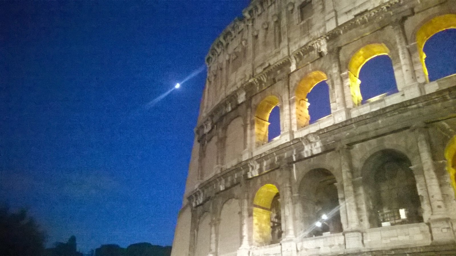
This of course is the Colosseum with the Moon.

This is my old home in San Lorenzo. I spent the academic year of 2006/2007 studying at Università degli studi Roma Tre.
Saluti da Roma,

Janne

Friday, October 3, 2014

Inverse problems

Hello,

yesterday I got an invitation to the 20th Inverse Days organized by The Finnish Inverse Problems Society (Suomen inversioseura ry). They have also put together a Youtube teaser and in that way I found myself watching various Youtube videos about ”inverse problems”.

Here are two of them. First one is Nutti Hyvönen’s installation lecture at Aalto University 


and the second one is an interview of my PhD supervisor Heikki Haario.


They are quite interesting. So check them out!

Loosely speaking, all the research that I do is somehow how related to these inverse problems. So now you now what I do :-)

Ciao,

Janne

Thursday, October 2, 2014

Estimating model error covariance matrix parameters in extended Kalman filtering

Hello,

about a month ago, Antti's paper "Estimating model error covariance matrix parameters in extended Kalman filtering" got published in Nonlinear Processes in Geophysics. It is a continuation of long series of papers, e.g., p1, p2, p3, p4, and also related to the main topic of my doctoral dissertation.

The paper discusses how Filter Likelihood -technique can be used for estimating the parameters of the model error covariance matrix in extended Kalman filtering. The paper shows that (a) the importance of the model error covariance matrix calibration depends on the quality of the observations, and that (b) the estimation approach yields a well-tuned EKF in terms of the accuracy of the state estimates and model predictions.

Today FMI published a tiedeuutinen about it. This is what came out:

Uusi menetelmä data-assimilaatiosysteemin säätämiseen

Vastajulkaistussa tutkimuksessa esitetään objektiivinen numeerinen menetelmä, jonka avulla data-assimilaation parametrit voidaan säätää kohdilleen, jotta säämalli ja havaintodata sulautuvat hyvin toisiinsa.

Data-assimilaatio on tekniikka, jonka avulla säämalli ja havaintodata voidaan sulauttaa yhteen. Se onkin keskeinen työkalu esimerkiksi numeerisessa säänennustamisessa. Useisiin data-assimilaatiotekniikoihin sisältyy termi, jonka tarkoituksena on kuvata sitä virhettä, jonka malli tekee liikuttaessa aikapisteestä toiseen. Toisaalta sen tarkoituksena on myös kompensoida niitä virheitä, joita itse data-assimilaatiosysteemiin liittyy. Perinteisesti on ajateltu, että tämä termi on mallintajan säätöparametri, jonka mallintaja asettaa käsin.

Uudessa tutkimuksessa voitiin osoittaa, että säädön tarpeellisuus riippuu olennaisesti käytettävien havaintojen tarkkuudesta ja määrästä.  Tutkimuksessa esitelty numeerinen algoritmi antaa hyvin säädetyn ennustesysteemin, jossa koko ennustesysteemin ennustevirhe on samassa suhteessa simuloidun oikean ennustevirheen kanssa.

Tutkimus on julkaistu kansainvälisessä Nonlinear Processes in Geophysics -tiedelehdessä ja siihen on osallistunut tutkijoita Ilmatieteen laitokselta, Lappeenrannan teknilliseltä yliopistolta ja  Aalto-yliopistolta. Tutkimus on tehty osana Suomen akatemian laskennallisten tieteiden tutkimusohjelmaan kuuluvaa NOVAC-projektia.

Lisätiedot:
Tutkija Antti Solonen, antti.solonen@gmail.com
Tutkija Janne Hakkarainen, janne.hakkarainen@fmi.fi

Linkki tutkimukseen: http://www.nonlin-processes-geophys.net/21/919/2014/

Check it out!

Citation: Solonen, A., Hakkarainen, J., Ilin, A., Abbas, M., and Bibov, A.: Estimating model error covariance matrix parameters in extended Kalman filtering, Nonlin. Processes Geophys., 21, 919-927, doi:10.5194/npg-21-919-2014, 2014.

Cheers,

Janne

Monday, September 29, 2014

Satellite Observations of Ash and SO2 from recent Volcanic Eruptions in Iceland

Hey guys,

this morning I submitted the following to the Finnish Remote Sensing Days 2014.

See you there!

Janne
Satellite Observations of Ash and SO2 from recent Volcanic Eruptions in Iceland
Janne Hakkarainen, Iolanda Ialongo, Simo Tukiainen, Rigel Kivi, Timo Ryyppö, Seppo Hassinen, and Johanna Tamminen

Finnish Meteorological Institute
P.O. BOX 505, FI-00101 Helsinki, Finland

Sulphur dioxide (SO2) has been measured from space since the 1982 eruption of El Chichòn [1]. Those measurements were carried out by Total Ozone Mapping Spectrometer (TOMS), which had a limited SO2 detection sensitivity, since the discrete measurement wavelengths were designed for total ozone measurements. Since those days, next-generation space-borne spectrometers like GOME, SCIAMACHY and OMI (Ozone Monitoring Instrument) have shown greatly improved SO2 detection sensitivity. These days, SO2 from volcanic eruptions and degassing are routinely monitored.

Satellite measurements of volcanic SO2 emissions can provide critical information for aviation hazard mitigation, particularly when ash detection techniques fail [2]. SO2 has low background making the volcanic SO2 plumes clearly distinguishable even long distance from source. For example systems like SACS (Support to Aviation Control Service, http://sacs.aeronomie.be) use SO2 as an indicator for volcanic activity and send email notifications when instrument specific thresholds are exceeded.

The fastest way to produce satellite data is to use the so-called direct-broadcast technique where the instruments measure the atmosphere and simultaneously send the data down to Earth for processing. These direct-readout data are provided about 15 min after the satellite overpasses the ground station. One of such systems was the Finnish OMI very fast delivery (VFD) service put together in 2004 for ozone and UV products. OMI VFD was updated in 2010—after the ill- famous Eyjafjallajökull eruption—for SO2 and aerosol products in order to monitor volcanic clouds. In 2011, OMI VFD system successfully monitored Grimsvötn eruption and both SO2 and aerosols were observed [3]. In 2014, new satellite observations from OMPS (Ozone Mapping and Profiler Suite) onboard Suomi-NPP were added, and the name of the system was changed to SAMPO (Satellite measurements from Polar orbit, http://sampo.fmi.fi).

In this paper, we present direct-readout satellite data from OMI VFD/SAMPO service. We show the volcanic ash and SO2 clouds from 2011 Grimsvötn explosive and 2014 Holuhraun fissure eruptions. In addition, we show comparisons against ground-based measurements from Helsinki (2011) and Northern Finland (2014).

References

[1] A.J. Krueger, N.A. Krotkov, and S.A. Carn (2008). El Chichon: the genesis of volcanic sulfur dioxide monitoring from space, J. Volcanol. Geotherm. Res., 175, 408-414, doi:10.1016/j.jvolgeores.2008.02.026.
[2] S.A. Carn, A.J. Krueger, N.A. Krotkov, K. Yang, and K. Evans (2009). Tracking volcanic sulfur dioxide clouds for aviation hazard mitigation. Natural Hazards, 51(2), 325-343, doi:10.1007/s11069-008-9228-4.
[3] V.-M. Kerminen, J.V. Niemi, H. Timonen, M. Aurela, A. Frey, S. Carbone, S. Saarikoski, K. Teinilä, J. Hakkarainen, J. Tamminen, J. Vira, M. Prank, M. Sofiev, and R. Hillamo (2011). Characterization of a volcanic ash episode in southern Finland caused by the Grimsvötn eruption in Iceland in May 2011, Atmos. Chem. Phys., 11, 12227-12239, doi:10.5194/acp-11-12227-2011.

Thursday, September 4, 2014

First ten years of OMI

Hello,

as I mentioned earlier, it has been ten years since the launch of OMI onboard EOS-Aura. Tuesday we had a little seminar here at FMI. After the seminar there where some snacks and alcoholic beverages...

OMI Co-PI Johanna Tamminen and Pekka T. Verronen celebrating the first ten years of OMI.

The first ten years of OMI have been really successful, and the instrument is still doing its job well. Here are the SO2 values that OMI observed yesterday

OMI observes SO2 plume from Iceland. http://sampo.fmi.fi

Ciao,

Janne

Tuesday, September 2, 2014

SAMPO detects SO2 in Iceland

Hello,

there has been indications about increasing seismic activity in Bárðarbunga since August 16th 2014 (Icelandic Met Office). Yesterday was the first day when SO2 was observable. Here are the first images. Let's hope that we get more of them today!

Puss och kram,

Janne


Wednesday, August 20, 2014

SAMPO observing moving aerosol cloud

Hello,

some days ago I advertised the new SAMPO (Satellite Measurements from Polar Orbit) service. One great thing about polar orbit satellites at high latitudes is that during one day the can observe the same spot many times. Here is one recent example where OMPS/SAMPO observes moving aerosol cloud — probably originating from Swedish wildfires — in four overpasses.

Thanks to my colleague Simo for spotting this!

Cheers,
Janne

Tuesday, August 19, 2014

New NASA Images Highlight U.S. Air Quality Improvement

Hello,

lately I have been posting about NO2 in Baltic Sea. This post is related to those. Essentially, the news tell us that air quality has gotten way better in the US (and the rest of the Western world), although, many seem to think the opposite. This is because of the regulations and cleaner technology, even when we have more cars on the roads today. Satellite images, as always, reveal the reduction quite objectively.

Anyway, the reason why I wanted to blog about this subject is that I wanted to show how tremendous job our colleagues at NASA do. Check this website out to see how scientific images should be presented. In particular, I like those before and after images. Very cool.

Unfortunately, other countries do not have organizations like NASA that understands the importance of great satellite images and open data. Blaah.

Nitrogen dioxide pollution, averaged yearly from 2005-2011, has decreased across the United States. Image Credit: NASA Goddard's Scientific Visualization Studio/T. Schindler

See also some news videos from here and here.

Ciao,
Janne

Friday, August 15, 2014

sampo.fmi.fi

Hello,

the good old OMI Very fast delivery service is now called SAMPO. The reason for the name change is that now we are also delivering OMPS data from the Suomi-NPP satellite.

The idea of the service is to provide data very quickly after the satellite overpasses FMI's Satellite Data Centre at Sodankylä, Northern Finland. Quickly here means some 15 minutes – the time that is needed to process the data. The service is based on so-called direct-readout concept where the instruments measure the atmosphere and simultaneously send the data down to Earth for processing.

You can find the new website here.

Check it out,
Janne

Btw. Read this Wikipedia article to learn what Sampo actually means.

Btw2. Did you know that Suomi is a Finnish word for Finland, and that the Suomi-NPP satellite is named after Verner Suomi, whose parents arrived in the US in 1902 from Finland.

Btw3. Example figures:


Thursday, August 7, 2014

Good science news: Characterization of OMI tropospheric NO2 over the Baltic Sea region, part 2

Hello,

more good news coming. The final version of Iolanda paper "Characterization of OMI tropospheric NO2 over the Baltic Sea region" got published yesterday in ACP. I have already mentioned the paper here and here. Here's the FMI's science news about it
Satellite observations provide information about the changes in air pollution from cities and ships in the Baltic Sea region
Satellite data are very important for air quality monitoring over large areas where ground-based and aircraft measurements are not available.
and slightly different version in Finnish
Satelliittihavainnoilla saadaan tietoa kaupunkien ja laivojen päästöistä Itämeren alueella
Uusi tutkimus osoittaa, että satelliittipohjaisia havaintoja voidaan hyödyntää myös Itämeren kaltaisilla alueilla, joissa päästöt ovat pieniä. Aikaisimmin satelliittihavaintoja on käytetty lähinnä erittäin voimakkaiden päästöalueiden, kuten Kiinan, Yhdysvaltojen itärannikon ja Keski-Euroopan, tutkimiseen. Satelliiteista saatavat havainnot ovat erittäin tärkeitä ilmanlaadun seurannan kannalta alueilla, joilla maanpinta- tai lentokonemittauksia ei ole saatavilla tai ne ovat harvassa.
This got also out as a press release, so let us hope that it gets some media attention too.  Yei.

All the best,

Janne

P.s. I am waiting one more paper to come out soon...

Monday, August 4, 2014

Bayesian optimization for tuning chaotic systems

Hello,

today is my first day at office and I am already writing the second blog post :-)

Anyway, I just received an email saying that Mudassar's paper "Bayesian optimization for tuning chaotic systems" has been published as a discussion paper in NPGD:

Citation: Abbas, M., Ilin, A., Solonen, A., Hakkarainen, J., Oja, E., and Järvinen, H.: Bayesian optimization for tuning chaotic systems, Nonlin. Processes Geophys. Discuss., 1, 1283-1312, doi:10.5194/npgd-1-1283-2014, 2014. Link

Check it out,

Janne

Ten years of Aura

Hello,

it has been 10 years since the launch of NASA's Aura spacecraft. One of the instruments on board—among MLS, TES, HIRDLS—is the Dutch-Finnish Ozone Monitoring instrument (OMI), which continued the legacy of TOMS, GOME and SCIAMACHY instruments.

As my boss, OMI CO-PI Johanna Tamminen, would say
OMI is a nadir looking UV-VIS instrument which measures ozone (O3), nitrogen dioxide (NO2), sulfur dioxide (SO2), aerosols, UV-radiation, and some other trace gases. The OMI has contributed strongly in our understanding of global distribution and variability of these constituents which play important roles for air quality and climate.
To celebrate the success. NASA has put together some news and videos. See
An Aura of Success
On the 10th anniversary of the launch of NASA's Aura spacecraft, we offer 10 examples of how the satellite has changed our view of dust, pollution, aerosols, and ozone in our atmosphere. Link
and
Ten-Year Endeavor: NASA’s Aura Tracks Pollutants
NASA’s Aura satellite, celebrating its 10th anniversary this year on July 15, has provided vital data about the cause, concentrations and impact of major air pollutants. With its four instruments measuring various gas concentrations, Aura gives a comprehensive view of one of the most important parts of Earth — the atmosphere. Link


This year's Aura Science Team Meeting and 10th year anniversary celebration will be held from Monday Sept. 15 to Thursday Sept. 18, 2014 at College Park, MD, USA. More information from this link. Note Johanna's presentation "Ten years of OMI measurements in Finland – a high latitude perspective".

Ciao,

Janne

Wednesday, July 2, 2014

Watching the OCO-2 launch

Hey,

today everything went smoothly.


Watching the launch from NASA TV 
Ciao,
Janne


Tuesday, July 1, 2014

OCO-2 launch delayed

Hello,

today at our FMI office we were gathered to watch the launch of OCO-2 from NASA TV. This was actually the second time, since the launch of the first version failed in 2009. Just 46 seconds before the launch, a failure in the launch pad water flow was found. Not cool.

Now we have to just wait and see what happens next.

See "Five Things about OCO-2" to learn more this instrument.
OCO-2 is NASA’s first mission dedicated to studying atmospheric carbon dioxide, the leading human-produced greenhouse gas driving changes in Earth’s climate.
 Also BBC article "Nasa satellite to seek 'missing carbon'" is interesting:
The $468m (£275m) OCO-2 mission is going to trace the global geographic distribution of carbon dioxide in the atmosphere - to try to identify precisely where it is emitted and absorbed. 
Cheers,

Janne

Update:
The launch of NASA’s Orbiting Carbon Observatory-2 (OCO-2) aboard a United Launch Alliance Delta II rocket is scheduled for Wednesday, July 2 at 5:56 a.m. EDT (2:56 a.m. PDT) from Space Launch Complex 2 at Vandenberg Air Force Base in California.
See it live: http://www.nasa.gov/multimedia/nasatv/

Friday, May 16, 2014

Pandora spectrometer at FMI's roof

Hello,

Yesterday I got a rare opportunity to do some "real work" when we went to assembly our new Pandora instrument on top of the FMI roof. My work was mainly to be cool on photograps... Anyway, Pandora is a ground-based spectrometer that observes ozone and NO2 among other things. Maybe I will blog more about these observations in the future, if something interesting happens. Now I just wanted to share some photos...

Ciao,

Janne

Me (center) and Niilo (left) being prepared to watch Jari to do the actual work.

Panorama from the FMI's roof.

The Pandora spectrometer is inside that black box.

The Pandora head sensor et al.

Yay, we got a radiance!